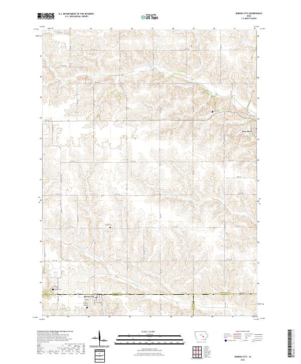
2022 Map of Barnes City
USGS Topo · Published 2022About this map
Barnes City sits at the intersection of Mahaska and Poweshiek counties, a rural landscape defined by the shifting tributaries of the Iowa prairie. The survey captures the town's position just north of the Keokuk County line, surrounded by agricultural sections and family-named landmarks. Several historic burial grounds, including the Boswell - Harper - Pioneer Cem and Lisor - Beulah Cem, are preserved across the sections, offering a look at the area's early settlement genealogy. The terrain is marked by the winding paths of the S English River and the Deep River, which cut through the agricultural grid of rural avenues. To the northeast, the smaller community of Deep River occupies a section near the headwaters of its namesake stream, highlighting the traditional Iowa pattern of small towns spaced along watercourses and county borders.
Find a feature on this map
32 named features on this map. Tap any name to fly to it.
Don’t see what you’re looking for? This feature index may not catch every label — zoom into the map to look around manually.
Map Details
Editions of this 2022 Barnes City Map
This is the sole edition of this map. No revisions or reprints were ever made.
Other maps of this area

1954 · Des Moines
USGS Topo · 1:250,000

1956 · Des Moines
USGS Topo · 1:250,000

1957 · Des Moines
USGS Topo · 1:250,000

1965 · Gibson
USGS Topo · 1:24,000

1965 · What Cheer
USGS Topo · 1:24,000

1968 · Deep River
USGS Topo · 1:24,000

1968 · Brooklyn
USGS Topo · 1:24,000

1968 · Victor
USGS Topo · 1:24,000

1968 · Barnes City
USGS Topo · 1:24,000

1969 · Des Moines
USGS Topo · 1:250,000