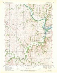
1968 Map of Barnes
USGS Topo · Published 1970About this map
The Little Blue River winds through the borderlands of Washington and Marshall Counties, where the Missouri Pacific Railroad cuts across the rolling landscape of north-central Kansas. This late-1960s survey documents the valley just as the Tuttle Creek Reservoir begins to influence the hydrology of the area, notably near the town of Waterville. The topographic detail preserves the locations of several community landmarks, including the Townhall in Cottage Hill and numerous rural burial grounds such as Mound Cem and Harbaugh Cem.
Find a feature on this map
21 named features on this map. Tap any name to fly to it.
Don’t see what you’re looking for? This feature index may not catch every label — zoom into the map to look around manually.
Map Details
Editions of this 1968 Barnes Map
2 editions found
Other maps of this area

1889 · Marysville
USGS Topo · 1:125,000

1894 · Marysville
USGS Topo · 1:125,000

1955 · Manhattan
USGS Topo · 1:250,000

1956 · Manhattan
USGS Topo · 1:250,000

1957 · Manhattan
USGS Topo · 1:250,000

1966 · Marysville
USGS Topo · 1:24,000

1966 · Hanover SE
USGS Topo · 1:24,000

1966 · Hanover SW
USGS Topo · 1:24,000
1968 · Kimeo
USGS Topo · 1:24,000
1968 · Greenleaf
USGS Topo · 1:24,000