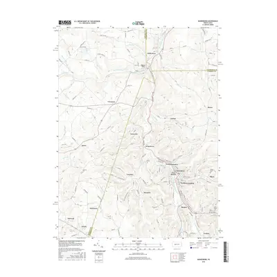
2016 Map of Barnesboro
USGS Topo · Published 2016About this map
The West Branch Susquehanna River carves through the coal-rich highlands of northern Cambria and Indiana Counties, defining the development of a string of industrial and residential settlements. The boroughs of Barnesboro and Spangler, later consolidated as Northern Cambria, appear alongside satellite communities like Marsteller and Emeigh. This landscape is marked by its deep religious and community heritage, evidenced by numerous burial grounds such as Saint Marys Cem, Saint Patricks Cem, and the McDowell Cem located near Spruce. Water management for the region is centered on the Cherry Tree Reservoir and Pioneer Lake, while the convergence of smaller tributaries like Cush Cushion Cr and Moss Cr highlights the complex drainage system of the Allegheny Front. The map traces the historical footprints of Garmantown, Greenwich, and Watkins, providing a detailed look at the local road networks and land divisions at the county lines.
Find a feature on this map
108 named features on this map. Tap any name to fly to it.
Don’t see what you’re looking for? This feature index may not catch every label — zoom into the map to look around manually.
Map Details
Editions of this 2016 Barnesboro Map
This is the sole edition of this map. No revisions or reprints were ever made.
Other maps of this area

1902 · Patton
USGS Topo · 1:62,500

1902 · Barnesboro
USGS Topo · 1:62,500

1903 · Curwensville
USGS Topo · 1:62,500

1904 · Barnesboro
USGS Topo · 1:62,500

1904 · Patton
USGS Topo · 1:62,500

1906 · Punxsutawney
USGS Topo · 1:62,500

1939 · Curwensville
USGS Topo · 1:62,500

1939 · Punxsutawney
USGS Topo · 1:62,500

1942 · Curwensville
USGS Topo · 1:62,500

1942 · Punxsutawney
USGS Topo · 1:62,500
Featured Places
- Northern Cambria, PA
- Cherry Tree, PA
- Watkins, Barr Township
- Pine Township, PA
- Garmantown, Susquehanna Township