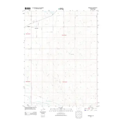
2013 Map of Barnesville
USGS Topo · Published 2013About this map
S Platte River defines the southern reach of this landscape, where complex irrigation infrastructure like the Empire Intake Canal and Riverside Intake Canal support the agricultural character of eastern Weld County. The small settlements of Barnesville and Matthews sit along a grid of county roads, connected by historical watercourses like Crow Creek. The map reveals a highly managed hydraulic environment, from the Greeley Number 2 Canal to the N Fork Ogilvy Ditch, illustrating how the High Plains were engineered for cultivation and livestock. Near the southern edge, the community of Kuner serves as a landmark point in this wide river valley, while further north, the presence of Wells Cow Camp reflects the region's enduring ranching heritage.
Find a feature on this map
27 named features on this map. Tap any name to fly to it.
Don’t see what you’re looking for? This feature index may not catch every label — zoom into the map to look around manually.
Map Details
Editions of this 2013 Barnesville Map
This is the sole edition of this map. No revisions or reprints were ever made.
Other maps of this area

1902 · Greeley
USGS Topo · 1:125,000

1908 · Eaton
USGS Topo · 1:125,000

1910 · Eaton
USGS Topo · 1:125,000

1950 · Kersey
USGS Topo · 1:24,000

1950 · Barnesville
USGS Topo · 1:24,000

1950 · Valley View School
USGS Topo · 1:24,000

1950 · Hardin
USGS Topo · 1:24,000

1951 · Hardin
USGS Topo · 1:24,000
1951 · Valley View School
USGS Topo · 1:24,000

1951 · Point Of Rocks
USGS Topo · 1:24,000