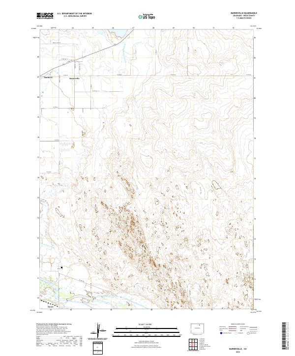
2022 Map of Barnesville
USGS Topo · Published 2022About this map
The South Platte River and its intricate network of irrigation systems define this portion of Weld County, illustrating the agricultural transformation of the High Plains. Small settlements like Barnesville and Matthews sit in the northern sections of the map, while Kuner occupies the southwestern corner near the riverbanks. The landscape is heavily marked by water management infrastructure, including the Greeley-Number 2 Canal, Empire Intake Canal, and Riverside Intake Canal, which divert vital water to the surrounding fields. For local historians and genealogists, the inclusion of Gerry Cem south of the N Fork Ogilvy Ditch provides a specific point of interest for family research. The extensive grid of county roads, such as Co RD 68 and Co RD 388, shows how the region was organized for farming and transport in the modern era.
Find a feature on this map
27 named features on this map. Tap any name to fly to it.
Don’t see what you’re looking for? This feature index may not catch every label — zoom into the map to look around manually.
Map Details
Editions of this 2022 Barnesville Map
This is the sole edition of this map. No revisions or reprints were ever made.
Other maps of this area

1902 · Greeley
USGS Topo · 1:125,000

1908 · Eaton
USGS Topo · 1:125,000

1910 · Eaton
USGS Topo · 1:125,000

1950 · Kersey
USGS Topo · 1:24,000

1950 · Barnesville
USGS Topo · 1:24,000

1950 · Valley View School
USGS Topo · 1:24,000

1950 · Hardin
USGS Topo · 1:24,000

1951 · Hardin
USGS Topo · 1:24,000
1951 · Valley View School
USGS Topo · 1:24,000

1951 · Point Of Rocks
USGS Topo · 1:24,000