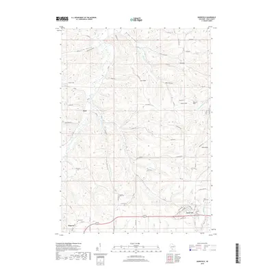
2018 Map of Barneveld
USGS Topo · Published 2018About this map
The village of Barneveld and the northern edge of Ridgeway anchor this Iowa County landscape, where the terrain transitions into a complex system of ridges and narrow valleys. The map reveals a deep connection to local genealogy through its numerous burial grounds, including the Jennieton Baptist Cem, Bethel Cem, and White Church Cem. The topography is defined by prominent landmarks such as Blue Ridge, Pinnacle Bluff, and the curious Indian Castle, all rising above a network of drainages like White Hollow Cr and Arneson Cr. Settlement patterns follow the winding coulees, with the community of Hyde situated along the banks of Mill Cr. The road network, including the modern alignment of US Highway 151 and rural routes like Amacher Hollow Rd, reflects how transportation routes have adapted to the Driftless Area's characteristic landforms.
Find a feature on this map
74 named features on this map. Tap any name to fly to it.
Don’t see what you’re looking for? This feature index may not catch every label — zoom into the map to look around manually.
Map Details
Editions of this 2018 Barneveld Map
This is the sole edition of this map. No revisions or reprints were ever made.
Other maps of this area

1902 · Mineral Point
USGS Topo · 1:125,000

1905 · Richland Center
USGS Topo · 1:125,000

1920 · Blue Mounds
USGS Topo · 1:62,500

1922 · Blue Mounds
USGS Topo · 1:62,500

1923 · Blanchardville
USGS Topo · 1:62,500

1954 · Rockford
USGS Topo · 1:250,000

1955 · Rockford
USGS Topo · 1:250,000

1957 · Madison
USGS Topo · 1:250,000

1958 · Rockford
USGS Topo · 1:250,000

1958 · La Crosse
USGS Topo · 1:250,000