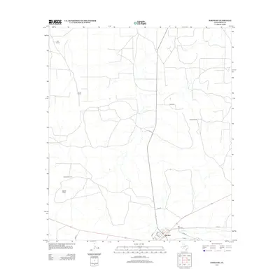
2012 Map of Barnhart
USGS Topo · Published 2012About this map
Barnhart serves as the primary focal point of this Irion County map, situated at the junction of several critical local thoroughfares. The landscape is defined by its ranching infrastructure, characterized by numerous water-pumping landmarks including Park Windmill, Park Trap Windmill, and Graphite Windmill. These features indicate a terrain where water management is essential for land use. To the east of the town center, the Rest Haven Cem provides a point of genealogical interest near the banks of Spring Cr. The region is further marked by the presence of Woods Draw, illustrating the natural drainage patterns of this West Texas environment. Local travel is facilitated by a network of county roads such as McAfee Rd and Co Rd-341, which connect the outlying ranch lands to the central settlement.
Find a feature on this map
20 named features on this map. Tap any name to fly to it.
Don’t see what you’re looking for? This feature index may not catch every label — zoom into the map to look around manually.
Map Details
Editions of this 2012 Barnhart Map
This is the sole edition of this map. No revisions or reprints were ever made.
Other maps of this area

1920 · Big Lake
USGS Topo · 1:62,500

1920 · Barnhart
USGS Topo · 1:62,500

1921 · Ketchum Mountain
USGS Topo · 1:62,500

1922 · Big Lake
USGS Topo · 1:62,500

1922 · Barnhart
USGS Topo · 1:62,500

1923 · Ketchum Mountain
USGS Topo · 1:62,500

1954 · San Angelo
USGS Topo · 1:250,000

1958 · San Angelo
USGS Topo · 1:250,000

1965 · San Angelo
USGS Topo · 1:250,000

1970 · South Mustang Draw SE
USGS Topo · 1:24,000