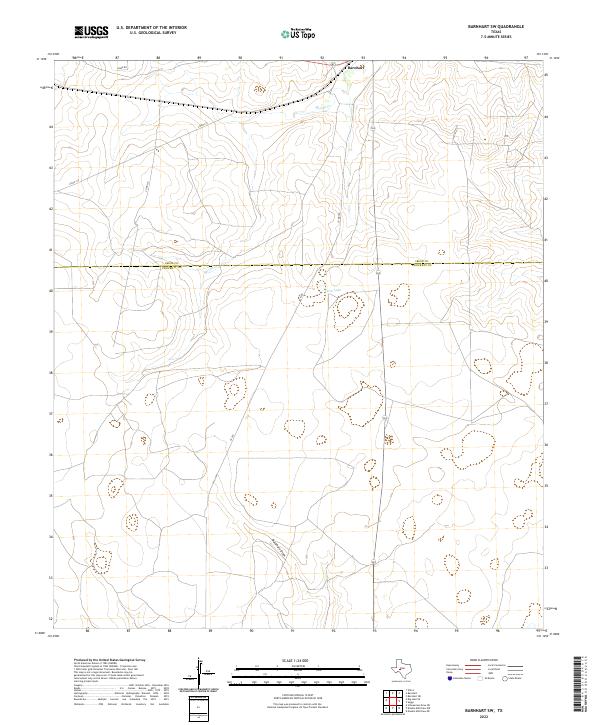
2022 Map of Barnhart SW
USGS Topo · Published 2022About this map
The boundary between Irion Co Crockett Co defines the central axis of this West Texas landscape, where the high desert terrain is shaped by ephemeral watercourses. In the northern section, the intermittent flow of Spring Cr meanders through the scrubland, eventually giving way to the depression of Twin Lake further south. The topography is dominated by wide, dry drainage systems like Buckhorn Draw, which illustrate the hydraulic patterns of this arid region. A sparse network of county roads, including Hinde Rd, Co Rd 312, and Co Rd 310, provides the only structural indicators of ranching or land management in this open country. The survey provides a clear view of the natural landforms and primary access routes that have likely defined property lines and livestock movement for generations across the county line.
Find a feature on this map
9 named features on this map. Tap any name to fly to it.
Don’t see what you’re looking for? This feature index may not catch every label — zoom into the map to look around manually.
Map Details
Editions of this 2022 Barnhart SW Map
This is the sole edition of this map. No revisions or reprints were ever made.
Other maps of this area

1920 · Big Lake
USGS Topo · 1:62,500

1920 · Barnhart
USGS Topo · 1:62,500

1922 · Big Lake
USGS Topo · 1:62,500

1922 · Barnhart
USGS Topo · 1:62,500

1954 · Sonora
USGS Topo · 1:250,000

1954 · San Angelo
USGS Topo · 1:250,000

1958 · Sonora
USGS Topo · 1:250,000

1958 · San Angelo
USGS Topo · 1:250,000

1965 · San Angelo
USGS Topo · 1:250,000
1967 · Schneeman Draw NE
USGS Topo · 1:24,000