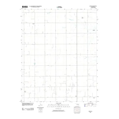
2009 Map of Barr
USGS Topo · Published 2009About this map
Wildwood Cemetery and other rural burial sites dot this section of Kingfisher County, where the landscape is defined by a strict section-line road grid. The presence of the Dunbar School in the southeastern quadrant serves as a marker of the area's educational history, while the Metz Landing Strip highlights the ongoing importance of private aviation in the Oklahoma plains. Water management is evidenced by the Oknoname 11901 Dam, indicating the local efforts to manage runoff and reservoir resources. Genealogists will find the locations of Cimarron Valley Cemetery and Morrison Cemetery particularly valuable for tracing local family histories within this agricultural corridor.
Find a feature on this map
19 named features on this map. Tap any name to fly to it.
Don’t see what you’re looking for? This feature index may not catch every label — zoom into the map to look around manually.
Map Details
Editions of this 2009 Barr Map
This is the sole edition of this map. No revisions or reprints were ever made.
Other maps of this area

1893 · Hennessey
USGS Topo · 1:62,500

1893 · Ames
USGS Topo · 1:62,500

1955 · Enid
USGS Topo · 1:250,000

1955 · Woodward
USGS Topo · 1:250,000

1956 · Ames
USGS Topo · 1:62,500

1956 · Hennessey
USGS Topo · 1:62,500

1956 · Enid
USGS Topo · 1:62,500

1956 · Ringwood
USGS Topo · 1:62,500

1958 · Enid
USGS Topo · 1:250,000

1958 · Woodward
USGS Topo · 1:250,000