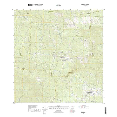
2018 Map of Barranquitas
USGS Topo · Published 2018About this map
Barranquitas serves as the central hub of this interior Puerto Rican landscape, situated where the Cordillera Central defines the island's mountainous backbone. The map provides a detailed view of the town's cultural institutions, including the campus of the Universidad Interamericana de Puerto Rico - Barranquitas and the Mausoleo Familia de Muñoz Rivera. To the south, the terrain drops dramatically into the Cañón de San Cristóbal, while numerous peaks like Cerro Farallón and Cerro Pulguillas overlook the winding river valleys of the Río Grande de Manatí and Río Usabón. Local history and genealogy are anchored by several burial sites, such as the Cementerio Municipal de Barranquitas and the Cementerio Municipal del Campo, which reflect the community's established roots in these highlands.
Find a feature on this map
46 named features on this map. Tap any name to fly to it.
Don’t see what you’re looking for? This feature index may not catch every label — zoom into the map to look around manually.
Map Details
Editions of this 2018 Barranquitas Map
This is the sole edition of this map. No revisions or reprints were ever made.
Other maps of this area

1945 · Rio Descalabrado
USGS Topo · 1:30,000

1946 · Coamo
USGS Topo · 1:30,000

1946 · Corozal
USGS Topo · 1:30,000

1946 · Barranquitas
USGS Topo · 1:30,000

1946 · Ciales
USGS Topo · 1:30,000

1946 · Cayey
USGS Topo · 1:30,000

1946 · Comerio
USGS Topo · 1:30,000

1946 · Naranjito
USGS Topo · 1:30,000

1946 · Orocovis
USGS Topo · 1:30,000

1947 · Corozal SO
USGS Topo · 1:10,000
Featured Places
- Aibonito
- Barranquitas
- La Guitarra, Comerío
- Sector Hayales de Barranquitas, Coamo
- Sector La Puntilla, Comerío