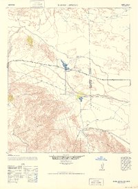
1947 Map of Barrel Spring
USGS Topo · Published 1952About this map
The Lower Borego Valley desert landscape, captured here in a 1947 survey, reveals a remote region defined by ephemeral hydrology and early industrial efforts. San Felipe Creek winds through the center of the sheet, feeding into arid features like Benson Dry Lake and Hatchill Dry Lake. The settlement of Ocotillo serves as a small waypoint along the highway, while Little Borego sits further south near the base of the Vallecito Mtns.
Find a feature on this map
18 named features on this map. Tap any name to fly to it.
Don’t see what you’re looking for? This feature index may not catch every label — zoom into the map to look around manually.
Map Details
Editions of this 1947 Barrel Spring Map
This is the sole edition of this map. No revisions or reprints were ever made.
Other maps of this area

1904 · Indio
USGS Topo · 1:125,000

1915 · El Centro
USGS Topo · 1:125,000

1931 · Vallecito
USGS Topo · 1:125,000

1931 · Carrizo
USGS Topo · 1:125,000

1939 · Borrego
USGS Topo · 1:62,500

1940 · Kane Spring
USGS Topo · 1:62,500

1940 · Plaster City
USGS Topo · 1:62,500

1940 · Durmid
USGS Topo · 1:62,500

1941 · Clark Lake
USGS Topo · 1:62,500

1942 · Barrel Spring
USGS Topo · 1:62,500