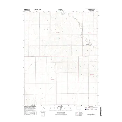
2016 Map of Barrel Springs Draw
USGS Topo · Published 2016About this map
Rush Creek and its smaller tributary Rush Cr meander through this portion of Lincoln County, defining a landscape of intermittent water sources and high plains drainage. The most prominent natural landmarks include the topographic depression of Rock Basin and the winding course of Barrel Springs Draw. This area is characterized by its reliance on seasonal water, as evidenced by the namesake Barrel Springs located centrally within the township.
Find a feature on this map
16 named features on this map. Tap any name to fly to it.
Don’t see what you’re looking for? This feature index may not catch every label — zoom into the map to look around manually.
Map Details
Editions of this 2016 Barrel Springs Draw Map
This is the sole edition of this map. No revisions or reprints were ever made.
Other maps of this area

1891 · Arroyo
USGS Topo · 1:125,000

1893 · Arroyo
USGS Topo · 1:125,000

1954 · Lamar
USGS Topo · 1:250,000

1958 · Lamar
USGS Topo · 1:250,000

1978 · Aroya
USGS Topo · 1:24,000

1978 · Barrel Springs Draw
USGS Topo · 1:24,000
1978 · Galatea SW
USGS Topo · 1:24,000

1978 · Rock Basin
USGS Topo · 1:24,000

1978 · Stacy Lakes Draw
USGS Topo · 1:24,000
1978 · Mc Kenzie Draw
USGS Topo · 1:24,000