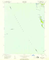
1942 Map of Barren Island
USGS Topo · Published 1957About this map
Barren Island sits at the center of this maritime survey, illustrating the complex shoreline of Dorchester County during the early 1940s. The map captures the significant role of aid to navigation in the Chesapeake Bay, identifying the Cedar Point Lighthouse on the western shore and the Hooper Island Lighthouse to the southeast. These markers served the vital shipping lanes that connected the Maryland coast. The intricate network of tidal waterways is visible through labels like The Big Broads, Long Marshes, and the Barren I Thorofare, which separates the main island from the mainland near Meekins Neck. This era shows the land as it was documented by the Army Map Service, providing a detailed record of coastal features like Houston Pt and Cove Pt before modern shoreline changes altered these marshes and beaches.
Find a feature on this map
22 named features on this map. Tap any name to fly to it.
Don’t see what you’re looking for? This feature index may not catch every label — zoom into the map to look around manually.
Map Details
Editions of this 1942 Barren Island Map
3 editions found
Other maps of this area

1892 · Drum Point
USGS Topo · 1:62,500

1894 · Point Lookout
USGS Topo · 1:62,500

1898 · St. Marys
USGS Topo · 1:125,000

1901 · Drum Point
USGS Topo · 1:62,500

1903 · Bloodsworth Island
USGS Topo · 1:62,500

1905 · Crapo
USGS Topo · 1:62,500

1905 · Drum Point
USGS Topo · 1:62,500

1906 · St. Marys
USGS Topo · 1:125,000

1912 · Point Lookout
USGS Topo · 1:62,500

1937 · Point Lookout
USGS Topo · 1:62,500