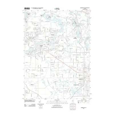
2012 Map of Barrington
USGS Topo · Published 2012About this map
The Fox River meanders through a landscape defined by an intricate network of glacial lakes and residential enclaves in this 2012 study of northeastern Illinois. This region, characterized by its high concentration of private estates and water-oriented communities, shows the developed character of Barrington and Barrington Hills. The map serves as a vital resource for genealogists, documenting several local burial grounds including Evergreen Cem, Saint Paul Cem, and White Cem.
Find a feature on this map
290 named features on this map. Tap any name to fly to it.
Don’t see what you’re looking for? This feature index may not catch every label — zoom into the map to look around manually.
Map Details
Editions of this 2012 Barrington Map
This is the sole edition of this map. No revisions or reprints were ever made.
Other maps of this area

1920 · Grays Lake
USGS Topo · 1:62,500

1923 · Grays Lake
USGS Topo · 1:62,500

1923 · Barrington
USGS Topo · 1:62,500

1925 · Elgin
USGS Topo · 1:62,500

1926 · Mc Henry
USGS Topo · 1:62,500

1935 · Barrington
USGS Topo · 1:62,500

1940 · Elgin
USGS Topo · 1:62,500

1944 · McHenry
USGS Topo · 1:62,500
1953 · Palatine
USGS Topo · 1:24,000

1954 · Rockford
USGS Topo · 1:250,000