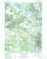
1993 Map of Barrington
USGS Topo · Published 1993About this map
The Fox River carves a deep valley through this corner of Northern Illinois, serving as the central axis for a series of established suburban and riverside communities. In the early 1990s, the landscape is defined by its numerous water bodies and conservation lands, including the sprawling County Forest Preserve and several private recreation areas like the Biltmore Country Club. The Chicago and North Western railroad line runs parallel to the river, anchoring the commercial centers of Cary and Fox River Grove.
Find a feature on this map
53 named features on this map. Tap any name to fly to it.
Don’t see what you’re looking for? This feature index may not catch every label — zoom into the map to look around manually.
Map Details
Editions of this 1993 Barrington Map
This is the sole edition of this map. No revisions or reprints were ever made.
Other maps of this area

1920 · Grays Lake
USGS Topo · 1:62,500

1923 · Grays Lake
USGS Topo · 1:62,500

1923 · Barrington
USGS Topo · 1:62,500

1925 · Elgin
USGS Topo · 1:62,500

1926 · Mc Henry
USGS Topo · 1:62,500

1935 · Barrington
USGS Topo · 1:62,500

1940 · Elgin
USGS Topo · 1:62,500

1944 · McHenry
USGS Topo · 1:62,500
1953 · Palatine
USGS Topo · 1:24,000

1954 · Rockford
USGS Topo · 1:250,000