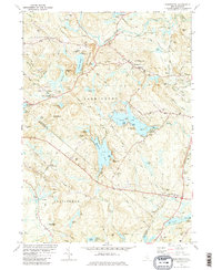
1981 Map of Barrington
USGS Topo · Published 1981About this map
Swains Lake and Mendums Pond dominate the central landscape of this early 1980s survey, illustrating a region defined by its abundant water bodies and wooded hills. The map highlights the rural character of southeastern New Hampshire, where small settlements like West Barrington and East Barrington are connected by historic routes such as Province Road and Longmarsh Road. The terrain is marked by distinctive elevations including Mount Misery, Huckleberry Hill, and Bumfagging Hill.
Find a feature on this map
67 named features on this map. Tap any name to fly to it.
Don’t see what you’re looking for? This feature index may not catch every label — zoom into the map to look around manually.
Map Details
Editions of this 1981 Barrington Map
2 editions found
Other maps of this area

1891 · Berwick
USGS Topo · 1:62,500

1893 · Dover
USGS Topo · 1:62,500

1893 · Berwick
USGS Topo · 1:62,500

1916 · Dover
USGS Topo · 1:62,500

1917 · Mt. Pawtuckaway
USGS Topo · 1:62,500

1918 · Dover
USGS Topo · 1:62,500

1919 · Mt. Pawtuckaway
USGS Topo · 1:62,500

1919 · Alton
USGS Topo · 1:62,500

1933 · Berwick
USGS Topo · 1:48,000

1937 · Berwick
USGS Topo · 1:62,500