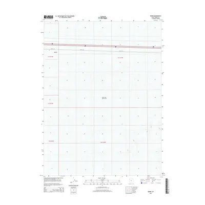
2014 Map of Barro
USGS Topo · Published 2014About this map
Barro sits at the edge of a vast, salt-encrusted landscape where the modern interstate corridor skirts the northern reaches of the Great Salt Lake Desert. The map reveals a transition between the stark, flat white expanse of the desert floor and the thin ribbon of infrastructure that supports transcontinental travel. Aside from the small settlement of Barro, the area is defined by the rigid geometry of the Public Land Survey System, with boundaries like t1s r15w and t1s r14w marking the townships. A solitary Frontage Rd runs parallel to the primary transportation route, providing the only local access through this sparsely populated section of Tooele County.
Find a feature on this map
8 named features on this map. Tap any name to fly to it.
Don’t see what you’re looking for? This feature index may not catch every label — zoom into the map to look around manually.
Map Details
Editions of this 2014 Barro Map
This is the sole edition of this map. No revisions or reprints were ever made.
Other maps of this area

1953 · Tooele
USGS Topo · 1:250,000

1955 · Tooele
USGS Topo · 1:250,000

1973 · Knolls SW
USGS Topo · 1:24,000

1973 · Arinosa SE
USGS Topo · 1:24,000

1973 · Arinosa NE
USGS Topo · 1:24,000

1973 · Floating Island SE
USGS Topo · 1:24,000

1973 · Knolls
USGS Topo · 1:24,000

1973 · Barro
USGS Topo · 1:24,000

1973 · Knolls SE
USGS Topo · 1:24,000

1973 · Knolls 2 SW
USGS Topo · 1:24,000