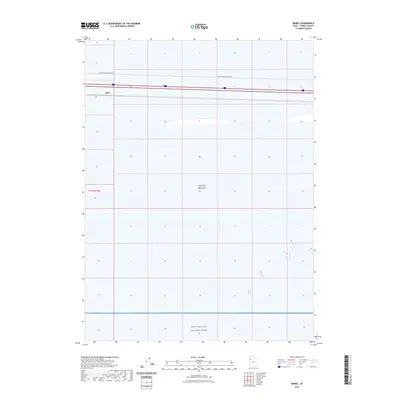
2023 Map of Barro
USGS Topo · Published 2023About this map
Great Salt Lake Desert dominates this Tooele County landscape, where the flat, alkaline expanse is punctuated by minimal infrastructure and military activity. The settlement of Barro sits along the northern edge of the desert, serving as a primary point of reference in an otherwise sparsely populated region. This 2023 survey illustrates the overlap of public lands and restricted zones, with the southern portion of the sheet dedicated to the Utah Test and Training Range. Transportation in this environment is limited to specific corridors such as Floating Island Dike Rd, which cuts through the desert floor to provide access across the salt flats. The mapping details the precise boundary lines of t1.5s r15w, showing the rectilinear survey sections that organize this vast, arid territory.
Find a feature on this map
7 named features on this map. Tap any name to fly to it.
Don’t see what you’re looking for? This feature index may not catch every label — zoom into the map to look around manually.
Map Details
Editions of this 2023 Barro Map
This is the sole edition of this map. No revisions or reprints were ever made.
Other maps of this area

1953 · Tooele
USGS Topo · 1:250,000

1955 · Tooele
USGS Topo · 1:250,000

1973 · Knolls SW
USGS Topo · 1:24,000

1973 · Arinosa SE
USGS Topo · 1:24,000

1973 · Arinosa NE
USGS Topo · 1:24,000

1973 · Floating Island SE
USGS Topo · 1:24,000

1973 · Knolls
USGS Topo · 1:24,000

1973 · Barro
USGS Topo · 1:24,000

1973 · Knolls SE
USGS Topo · 1:24,000

1973 · Knolls 2 SW
USGS Topo · 1:24,000