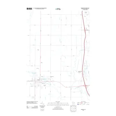
2013 Map of Barron
USGS Topo · Published 2013About this map
Barron serves as the focal point of this 2013 survey, situated at the confluence of the Yellow River and Quaderer Cr. The landscape is defined by its water management and agricultural heritage, featuring prominent impoundments like Barron Flowage Number One 142 and Barron Flowage Number Three 109. Named agricultural sites including Sterling Farm, Lane Yule Farm, and Jerland Farms are clearly marked, illustrating the persistence of family-named landholdings in Barron County. Aviation infrastructure is well-represented by both the Barron Municipal Airport and the Rice Lake Regional Airport - Carl's Field. The river systems, including the Red Cedar River and its various tributaries such as Fourmile Cr and Johnson Cr, create a complex drainage network that has historically shaped the development of this northern Wisconsin community.
Find a feature on this map
70 named features on this map. Tap any name to fly to it.
Don’t see what you’re looking for? This feature index may not catch every label — zoom into the map to look around manually.
Map Details
Editions of this 2013 Barron Map
This is the sole edition of this map. No revisions or reprints were ever made.
Other maps of this area

1949 · Rice Lake
USGS Topo · 1:48,000

1951 · Shell Lake
USGS Topo · 1:48,000

1951 · Rice Lake
USGS Topo · 1:48,000

1951 · Chetek
USGS Topo · 1:62,500

1951 · Barron
USGS Topo · 1:62,500

1953 · Rice Lake
USGS Topo · 1:250,000

1959 · Rice Lake
USGS Topo · 1:250,000

1965 · Rice Lake
USGS Topo · 1:62,500

1965 · Shell Lake
USGS Topo · 1:62,500
1978 · Poskin
USGS Topo · 1:24,000