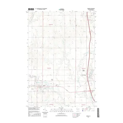
2015 Map of Barron
USGS Topo · Published 2015About this map
The Yellow River and Quaderer Cr converge at Barron, the central settlement of this Barron County landscape. This 2015 survey illustrates a region defined by water management and aviation, with the Barron Flowage and Cameron Flowage regulating local river levels while the Barron Municipal Airport and Rice Lake Regional Airport - Carl's Field serve as regional transport hubs. The city of Barron is meticulously detailed, showing the street grid from W Division Ave to E LaSalle Ave. Outside the town center, the land is marked by small family and community anchors such as Swede Cem and Wayside Cem. The Red Cedar River meanders through the eastern portion of the map, joined by tributaries like Barker Cr and Johnson Cr, creating a complex network of wetlands and creek beds across the township lines.
Find a feature on this map
72 named features on this map. Tap any name to fly to it.
Don’t see what you’re looking for? This feature index may not catch every label — zoom into the map to look around manually.
Map Details
Editions of this 2015 Barron Map
This is the sole edition of this map. No revisions or reprints were ever made.
Other maps of this area

1949 · Rice Lake
USGS Topo · 1:48,000

1951 · Shell Lake
USGS Topo · 1:48,000

1951 · Rice Lake
USGS Topo · 1:48,000

1951 · Chetek
USGS Topo · 1:62,500

1951 · Barron
USGS Topo · 1:62,500

1953 · Rice Lake
USGS Topo · 1:250,000

1959 · Rice Lake
USGS Topo · 1:250,000

1965 · Rice Lake
USGS Topo · 1:62,500

1965 · Shell Lake
USGS Topo · 1:62,500
1978 · Poskin
USGS Topo · 1:24,000