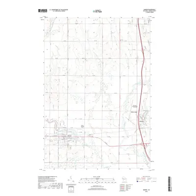
2018 Map of Barron
USGS Topo · Published 2018About this map
The Yellow River and Red Cedar River converge in this section of Barron County, shaping the development of Barron, Cameron, and the southern outskirts of Rice Lake. The landscape is a mixture of riparian corridors and a dense grid of rural roads, such as 19th Ave and 14th St, which serve the agricultural and residential plots between the settlements. Aviation interests are well-represented by both the Barron Municipal Airport and the Rice Lake Regional Airport - Carl's Field, highlighting the area's role as a regional hub.
Find a feature on this map
77 named features on this map. Tap any name to fly to it.
Don’t see what you’re looking for? This feature index may not catch every label — zoom into the map to look around manually.
Map Details
Editions of this 2018 Barron Map
This is the sole edition of this map. No revisions or reprints were ever made.
Other maps of this area

1949 · Rice Lake
USGS Topo · 1:48,000

1951 · Shell Lake
USGS Topo · 1:48,000

1951 · Rice Lake
USGS Topo · 1:48,000

1951 · Chetek
USGS Topo · 1:62,500

1951 · Barron
USGS Topo · 1:62,500

1953 · Rice Lake
USGS Topo · 1:250,000

1959 · Rice Lake
USGS Topo · 1:250,000

1965 · Rice Lake
USGS Topo · 1:62,500

1965 · Shell Lake
USGS Topo · 1:62,500
1978 · Poskin
USGS Topo · 1:24,000