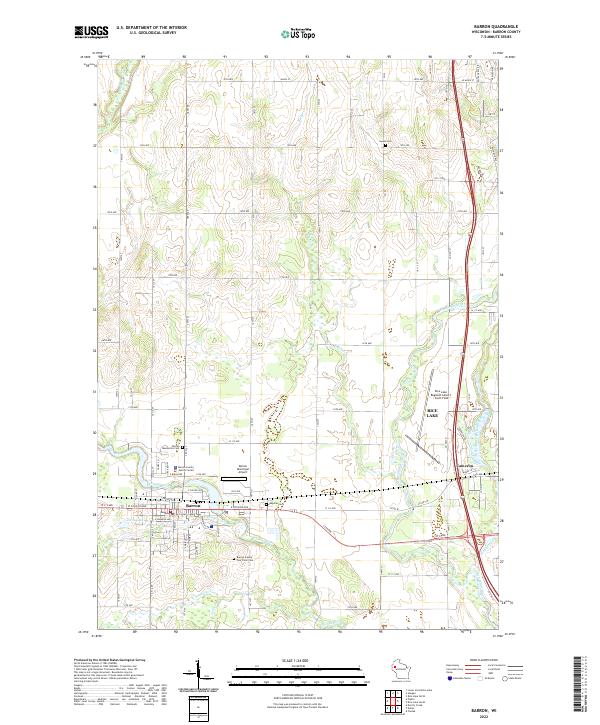
2022 Map of Barron
USGS Topo · Published 2022About this map
Barron and Cameron serve as the primary hubs in this portion of northwestern Wisconsin, where the Yellow River and Red Cedar River converge. The landscape is defined by a dense grid of township and range roads that reflect the area's agricultural foundations. Several local cemeteries, including the Barron Mennonite Cem, Swede Cem, and Wayside Cem, provide essential anchor points for genealogists tracing family histories in the region.
Find a feature on this map
79 named features on this map. Tap any name to fly to it.
Don’t see what you’re looking for? This feature index may not catch every label — zoom into the map to look around manually.
Map Details
Editions of this 2022 Barron Map
This is the sole edition of this map. No revisions or reprints were ever made.
Other maps of this area

1949 · Rice Lake
USGS Topo · 1:48,000

1951 · Shell Lake
USGS Topo · 1:48,000

1951 · Rice Lake
USGS Topo · 1:48,000

1951 · Chetek
USGS Topo · 1:62,500

1951 · Barron
USGS Topo · 1:62,500

1953 · Rice Lake
USGS Topo · 1:250,000

1959 · Rice Lake
USGS Topo · 1:250,000

1965 · Rice Lake
USGS Topo · 1:62,500

1965 · Shell Lake
USGS Topo · 1:62,500
1978 · Poskin
USGS Topo · 1:24,000