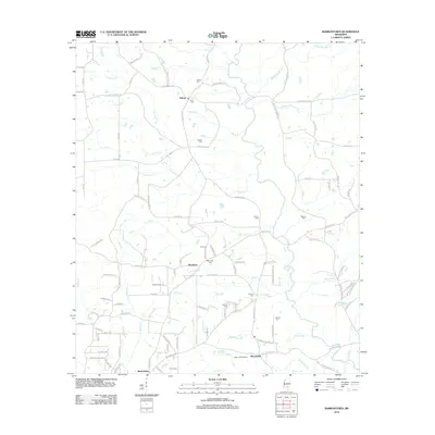
2012 Map of Barrontown
USGS Topo · Published 2012About this map
Tallahala Cr meanders south through this landscape, defining the local drainage patterns that shaped the small communities of Morriston and Barrontown. In the early 2010s, this area of Mississippi shows a distribution of several family-named burial grounds, including Morriston Cem, Odoms Cem, and Runnels Cem, which offer significant value for genealogists tracing local lineage. The topography is further marked by the Petal Lookout Tower near Macedonia, a prominent landmark in a region defined by numerous small waterways like Jasshead Cr, Gillis Cr, and McWilliams Br. The network of country roads such as Augusta Rd and Ovett Moselle Rd connects these rural settlements, reflecting a long-established pattern of southern Mississippi land use where creek-side agriculture and forestry prevail.
Find a feature on this map
110 named features on this map. Tap any name to fly to it.
Don’t see what you’re looking for? This feature index may not catch every label — zoom into the map to look around manually.
Map Details
Editions of this 2012 Barrontown Map
This is the sole edition of this map. No revisions or reprints were ever made.
Other maps of this area

1953 · Hattiesburg
USGS Topo · 1:250,000

1958 · Hattiesburg
USGS Topo · 1:250,000

1963 · Barrontown
USGS Topo · 1:24,000

1964 · Carterville
USGS Topo · 1:24,000

1964 · Ovett SE
USGS Topo · 1:24,000

1964 · Ovett
USGS Topo · 1:24,000

1964 · Ellisville
USGS Topo · 1:24,000

1964 · Hattiesburg
USGS Topo · 1:24,000

1964 · Lanham
USGS Topo · 1:24,000

1965 · Eastabuchie
USGS Topo · 1:24,000