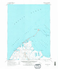
1955 Map of Barrow B-4
USGS Topo · Published 1977About this map
Point Barrow marks the northernmost tip of the United States on this mid-century survey, where the Arctic Ocean meets the Chukchi Sea and Beaufort Sea. The settlement of Barrow serves as the focal point of the coastline, flanked by Browerville and several lagoons such as Isatkoak Lagoon and Middle Salt Lagoon. This era shows significant strategic and scientific expansion in the high arctic, including the Naval Arctic Research Laboratory and the Barrow Air Force Radar Site situated near North Salt Lagoon.
Find a feature on this map
37 named features on this map. Tap any name to fly to it.
Don’t see what you’re looking for? This feature index may not catch every label — zoom into the map to look around manually.
Map Details
Editions of this 1955 Barrow B-4 Map
2 editions found
Other maps of this area

1945 · Barrow
USGS Topo · 1:250,000

1949 · Barrow
USGS Topo · 1:250,000

1955 · Barrow
USGS Topo · 1:250,000

1955 · Barrow B-4
USGS Topo · 1:63,360

1955 · Barrow A-4
USGS Topo · 1:63,360

1955 · Barrow A-5
USGS Topo · 1:63,360

1955 · Barrow A-3
USGS Topo · 1:63,360
1955 · Barrow B-3
USGS Topo · 1:63,360
1962 · Barrow B-4
USGS Topo · 1:50,000
1962 · Barrow A-4
USGS Topo · 1:50,000