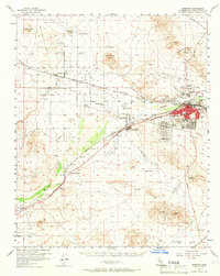
1956 Map of Barstow
USGS Topo · Published 1966About this map
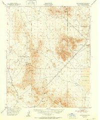
The Mojave River valley serves as a critical transportation corridor in the mid-1950s, where the infrastructure of the Santa Fe Atchison Topeka and Santa Fe and Union Pacific railroads converges near Barstow. The town is depicted as a growing hub, featuring established community sites like Foglesong Park, Cameron Sch, and a Sewage Treatment plant. Beyond the town center, the landscape is defined by a mix of agriculture and industry, with the Hinkley Valley Grange supporting local farmers while the Waterman Mine and Pedry Mine indicate the region's enduring mineral interests. This era captures the transition of the desert floor into a more structured residential and logistical landscape, evidenced by the development at Lenwood and the presence of contemporary leisure sites like the Drive-in Theater. Smaller settlements and family landmarks, including Johnstons Corner, Hinkley, and the Baxter Ranch, anchor the outlying territories.
Find a feature on this map
43 named features on this map. Tap any name to fly to it.
Don’t see what you’re looking for? This feature index may not catch every label — zoom into the map to look around manually.
Map Details
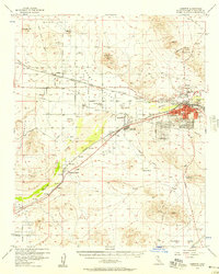
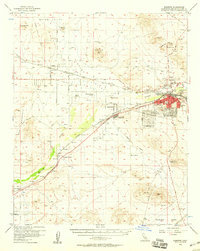
Editions of this 1956 Barstow Map
3 editions found
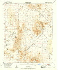
Other maps of this area

1915 · Searles Lake
USGS Topo · 1:250,000

1932 · Barstow
USGS Topo · 1:125,000

1933 · Avawatz Mountains
USGS Topo · 1:250,000

1934 · Barstow
USGS Topo · 1:125,000

1947 · Trona
USGS Topo · 1:250,000

1948 · Trona
USGS Topo · 1:250,000
1948 · Lane Mountain
USGS Topo · 1:62,500
1951 · Lane Mountain
USGS Topo · 1:62,500

1953 · San Bernardino
USGS Topo · 1:250,000

1953 · Trona
USGS Topo · 1:250,000