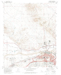
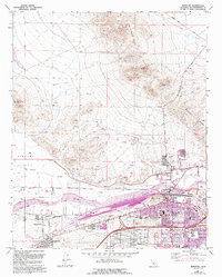
1971 Map of Barstow
USGS Topo · Published 1988About this map
Barstow serves as a critical desert junction in the early 1970s, defined by the meeting of the Atchison Topeka and Santa Fe and Union Pacific railroads. The town's grid expands south of the Mojave River, while industrial activity is evident at the Waterman Mine in the northern Waterman Hills and various Gravel Pits along the valley floor. The map captures a period of civic development with numerous educational sites like Kennedy High Sch and St Joseph Sch, alongside essential infrastructure like the Community Hospital and City Hall. To the west, the landscape transitions into the Hinkley Valley, where the community of Lenwood and the smaller Grandview settlement sit between the rail lines and Community Boulevard. This layout reflects the area's dual identity as a regional transportation hub and an established residential center.
Find a feature on this map
63 named features on this map. Tap any name to fly to it.
Don’t see what you’re looking for? This feature index may not catch every label — zoom into the map to look around manually.
Map Details
Editions of this 1971 Barstow Map
5 editions found
Other maps of this area

1915 · Searles Lake
USGS Topo · 1:250,000

1932 · Barstow
USGS Topo · 1:125,000

1933 · Avawatz Mountains
USGS Topo · 1:250,000

1934 · Barstow
USGS Topo · 1:125,000

1947 · Trona
USGS Topo · 1:250,000

1948 · Trona
USGS Topo · 1:250,000

1948 · Lane Mountain
USGS Topo · 1:62,500

1951 · Lane Mountain
USGS Topo · 1:62,500

1953 · San Bernardino
USGS Topo · 1:250,000

1953 · Trona
USGS Topo · 1:250,000