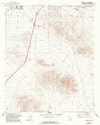
1971 Map of Barstow SE
USGS Topo · Published 1993About this map
Lenwood and the southwestern outskirts of Barstow anchor this landscape during a period of significant suburban and commercial expansion. The map illustrates the shifting southern corporate limits of Barstow, revealing how the city moved into the desert with new residential streets like Linda Vista Ave and Crestview Ave. Near the intersection of major thoroughfares, the emergence of a large Shopping Center and Athletic Fields adjacent to Barstow College signals the transition from a remote desert outpost to a modern regional hub.
Find a feature on this map
23 named features on this map. Tap any name to fly to it.
Don’t see what you’re looking for? This feature index may not catch every label — zoom into the map to look around manually.
Map Details
Editions of this 1971 Barstow SE Map
2 editions found
Other maps of this area

1932 · Barstow
USGS Topo · 1:125,000

1934 · Barstow
USGS Topo · 1:125,000

1953 · San Bernardino
USGS Topo · 1:250,000
1953 · Nebo
USGS Topo · 1:24,000

1955 · Ord Mountains
USGS Topo · 1:62,500

1956 · San Bernardino
USGS Topo · 1:250,000

1956 · Daggett
USGS Topo · 1:62,500

1956 · Barstow
USGS Topo · 1:62,500

1957 · Apple Valley
USGS Topo · 1:62,500

1957 · San Bernardino
USGS Topo · 1:250,000