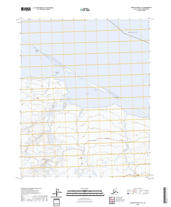
2024 Map of Barter Island A-4 SE
USGS Topo · Published 2024About this map
The Arctic National Wildlife Refuge dominates this northern landscape where the coastal plain meets the icy waters of the Beaufort Sea. Along the dynamic shoreline, narrow landforms such as Tapkaurak Spit and Griffin Point buffer the mainland from the open ocean, creating protected waters like Oruktalik Lagoon. This 2024 survey documents a remote wilderness defined by shifting aquatic boundaries, from the Oruktalik Entrance to the braided paths of the Niguanak River. Inland, the terrain is a complex network of wetlands and tundra, drained by the John River and Pokok Creek. The absence of roads or permanent settlements emphasizes the preserved character of this North Slope environment, where the landscape remains dictated by natural hydrographic processes and seasonal change.
Find a feature on this map
13 named features on this map. Tap any name to fly to it.
Don’t see what you’re looking for? This feature index may not catch every label — zoom into the map to look around manually.
Map Details
Editions of this 2024 Barter Island A-4 SE Map
This is the sole edition of this map. No revisions or reprints were ever made.
Other maps of this area

1951 · Barter Island
USGS Topo · 1:250,000

1951 · Demarcation Point
USGS Topo · 1:250,000

1955 · Demarcation Point
USGS Topo · 1:250,000

1955 · Demarcation Point D-3
USGS Topo · 1:63,360

1955 · Barter Island A-4
USGS Topo · 1:63,360
1955 · Barter Island A-3
USGS Topo · 1:63,360

1955 · Demarcation Point D-4
USGS Topo · 1:63,360

1959 · Barter Island
USGS Topo · 1:250,000

1962 · Demarcation Point D-3
USGS Topo · 1:50,000

1964 · Demarcation Point
USGS Topo · 1:250,000