
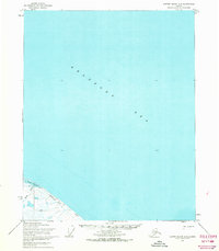
1962 Map of Demarcation Point D-3
USGS Topo · Published 1962About this map
Humphrey Point and the coastal lagoons of the Beaufort Sea dominate this mid-century arctic landscape along Alaska's northern coast. The map reveals the intricate shoreline geography where the Angnun River and Sikulahtukvik River meet the tidal waters of Angnun Lagoon and Pokok Lagoon. This 1950s-era survey captures the specialized infrastructure of the far north, showing a Landing strip and Tower at Nuvagapak Point, alongside a Tractor Trail that provides the primary overland route across the tundra. The mapping represents a transition in arctic exploration, utilizing photogrammetric methods from 1958 and coastal hydrography to detail the shifting sands and mudflats of Nuvagapak Lagoon.
Find a feature on this map
13 named features on this map. Tap any name to fly to it.
Don’t see what you’re looking for? This feature index may not catch every label — zoom into the map to look around manually.
Map Details
Editions of this 1962 Demarcation Point D-3 Map
This is the sole edition of this map. No revisions or reprints were ever made.
Other maps of this area

1951 · Barter Island
USGS Topo · 1:250,000

1951 · Demarcation Point
USGS Topo · 1:250,000

1955 · Demarcation Point
USGS Topo · 1:250,000

1955 · Demarcation Point D-3
USGS Topo · 1:63,360

1955 · Demarcation Point C-4
USGS Topo · 1:63,360

1955 · Demarcation Point D-2
USGS Topo · 1:63,360

1955 · Barter Island A-4
USGS Topo · 1:63,360
1955 · Barter Island A-3
USGS Topo · 1:63,360

1955 · Demarcation Point C-2
USGS Topo · 1:63,360

1955 · Demarcation Point D-4
USGS Topo · 1:63,360