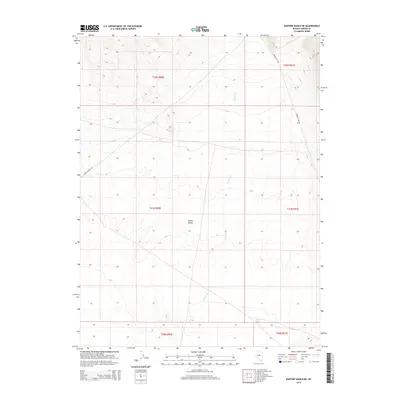
2014 Map of Bartine Ranch NE
USGS Topo · Published 2014About this map
Kobeh Valley dominates the central terrain of this Eureka County region, providing a look at the desert landscape in the early twenty-first century. The southern portion of the quadrangle is defined by the ephemeral flows near Mud Spring, where the drainage of Roberts Cr moves through the valley floor. Historically significant transportation routes intersect the basin, most notably the Pony Express Trl, which traverses the western slopes. Modern infrastructure is represented by Roberts Crk Rd, which skirts the eastern foothills. This survey by the U.S. Geological Survey documents the relationship between traditional overland trails and contemporary drainage patterns in this sparsely settled corner of Nevada.
Find a feature on this map
11 named features on this map. Tap any name to fly to it.
Don’t see what you’re looking for? This feature index may not catch every label — zoom into the map to look around manually.
Map Details
Editions of this 2014 Bartine Ranch NE Map
This is the sole edition of this map. No revisions or reprints were ever made.
Other maps of this area

1926 · Roberts Mountains
USGS Topo · 1:250,000

1929 · Roberts Mountains
USGS Topo · 1:250,000

1949 · Garden Valley
USGS Topo · 1:62,500

1949 · Roberts Creek Mtn
USGS Topo · 1:62,500

1951 · Roberts Creek Mtn
USGS Topo · 1:62,500

1951 · Garden Valley
USGS Topo · 1:62,500

1955 · Millett
USGS Topo · 1:250,000

1956 · Bartine Ranch
USGS Topo · 1:62,500

1956 · Whistler Mtn
USGS Topo · 1:62,500

1959 · Millett
USGS Topo · 1:250,000