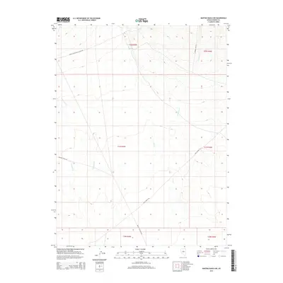
2015 Map of Bartine Ranch NW
USGS Topo · Published 2015About this map
The Pony Express Trl cuts across this high-elevation landscape in Eureka County, providing a direct link to the historic westward mail route that shaped this region's development. This 2015 survey by the U.S. Geological Survey captures a network of rural ranching roads, including Roberts Creek Santa Fe Ranch Rd and Ferguson Ranch Rd, which connect isolated homesteads and grazing lands. The hydrology of the area is defined by several seasonal drainages, most notably Coils Cr and Rutabaga Cr, which descend from the surrounding ridges. These drainage patterns, alongside the Bartine To Jd Ranch Rd, reveal the topographical constraints and water-dependent nature of land use in this part of Nevada. The map preserves the exact alignment of these routes and waterways, offering clear evidence of how the landscape has been navigated and managed for decades.
Find a feature on this map
15 named features on this map. Tap any name to fly to it.
Don’t see what you’re looking for? This feature index may not catch every label — zoom into the map to look around manually.
Map Details
Editions of this 2015 Bartine Ranch NW Map
This is the sole edition of this map. No revisions or reprints were ever made.
Other maps of this area

1926 · Roberts Mountains
USGS Topo · 1:250,000

1929 · Roberts Mountains
USGS Topo · 1:250,000

1949 · Roberts Creek Mtn
USGS Topo · 1:62,500

1951 · Roberts Creek Mtn
USGS Topo · 1:62,500

1955 · Millett
USGS Topo · 1:250,000

1956 · Bartine Ranch
USGS Topo · 1:62,500

1956 · Walti Hot Springs
USGS Topo · 1:62,500

1956 · Ackerman Canyon
USGS Topo · 1:62,500

1959 · Millett
USGS Topo · 1:250,000

1979 · Simpson Park Mtns
USGS Topo · 1:100,000