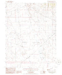
1986 Map of Bartine Ranch NW
USGS Topo · Published 1986About this map
The Old Pony Express Trail cuts a diagonal path across the landscape of Kobeh Valley, providing a clear record of this important mid-19th-century mail route. Surveyed by the Geological Survey in the 1980s, the map reveals a remote Nevada basin defined by seasonal drainages and essential water sources. Water is the primary driver of human presence in this arid region, evidenced by landmarks like Mint Well and the braided courses of Colls Creek and Rutabago Creek as they flow toward Willow Wash. The map documents a sparsely populated area where historical transit routes like the Pony Express were dictated by the natural contours and hydrology of the high desert floor.
Find a feature on this map
6 named features on this map. Tap any name to fly to it.
Don’t see what you’re looking for? This feature index may not catch every label — zoom into the map to look around manually.
Map Details
Editions of this 1986 Bartine Ranch NW Map
This is the sole edition of this map. No revisions or reprints were ever made.
Other maps of this area

1926 · Roberts Mountains
USGS Topo · 1:250,000

1929 · Roberts Mountains
USGS Topo · 1:250,000

1949 · Roberts Creek Mtn
USGS Topo · 1:62,500

1951 · Roberts Creek Mtn
USGS Topo · 1:62,500

1955 · Millett
USGS Topo · 1:250,000

1956 · Bartine Ranch
USGS Topo · 1:62,500

1956 · Walti Hot Springs
USGS Topo · 1:62,500

1956 · Ackerman Canyon
USGS Topo · 1:62,500

1959 · Millett
USGS Topo · 1:250,000

1979 · Simpson Park Mtns
USGS Topo · 1:100,000