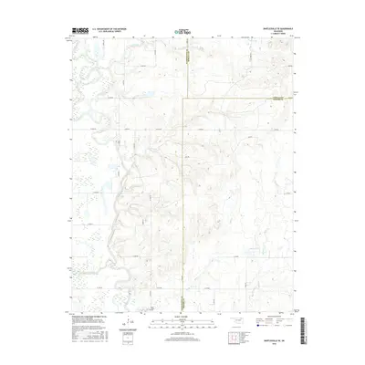
2016 Map of Bartlesville SE
USGS Topo · Published 2016About this map
The Caney River winds through this section of northeastern Oklahoma, defining the border between Washington, Nowata, and Rogers counties. This 2016 survey documents the rural character of the region southeast of Bartlesville, where family and community heritage is anchored by sites like Tyner Cem and Buck Creek Cem. The landscape is a network of watercourses and agricultural drainage, with Curl Creek and Fourmile Cr feeding into the river system from the north.
Find a feature on this map
40 named features on this map. Tap any name to fly to it.
Don’t see what you’re looking for? This feature index may not catch every label — zoom into the map to look around manually.
Map Details
Editions of this 2016 Bartlesville SE Map
This is the sole edition of this map. No revisions or reprints were ever made.
Other maps of this area

1901 · Claremore
USGS Topo · 1:125,000

1901 · Nowata
USGS Topo · 1:125,000

1914 · Nowata
USGS Topo · 1:125,000

1914 · Claremore
USGS Topo · 1:125,000

1916 · Claremore
USGS Topo · 1:125,000

1954 · Tulsa
USGS Topo · 1:250,000

1958 · Tulsa
USGS Topo · 1:250,000

1959 · Collinsville NE
USGS Topo · 1:24,000
1959 · Vera
USGS Topo · 1:24,000

1963 · Tulsa
USGS Topo · 1:250,000