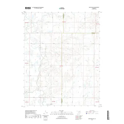
2019 Map of Bartlesville SE
USGS Topo · Published 2019About this map
The Caney River meanders through this portion of Rogers County, defining a landscape shaped by its many tributaries including Timberlake Creek, Curl Creek, and Fourmile Cr. This area, situated where the borders of Washington, Nowata, and Rogers Counties meet, remains characterized by its rural section-line road network and family history sites. Notable for genealogists are the Tyner Cem and Buck Creek Cem, which serve as quiet markers of the community's heritage amidst the rolling Oklahoma terrain.
Find a feature on this map
47 named features on this map. Tap any name to fly to it.
Don’t see what you’re looking for? This feature index may not catch every label — zoom into the map to look around manually.
Map Details
Editions of this 2019 Bartlesville SE Map
This is the sole edition of this map. No revisions or reprints were ever made.
Other maps of this area

1901 · Claremore
USGS Topo · 1:125,000

1901 · Nowata
USGS Topo · 1:125,000

1914 · Nowata
USGS Topo · 1:125,000

1914 · Claremore
USGS Topo · 1:125,000

1916 · Claremore
USGS Topo · 1:125,000

1954 · Tulsa
USGS Topo · 1:250,000

1958 · Tulsa
USGS Topo · 1:250,000

1959 · Collinsville NE
USGS Topo · 1:24,000
1959 · Vera
USGS Topo · 1:24,000

1963 · Tulsa
USGS Topo · 1:250,000