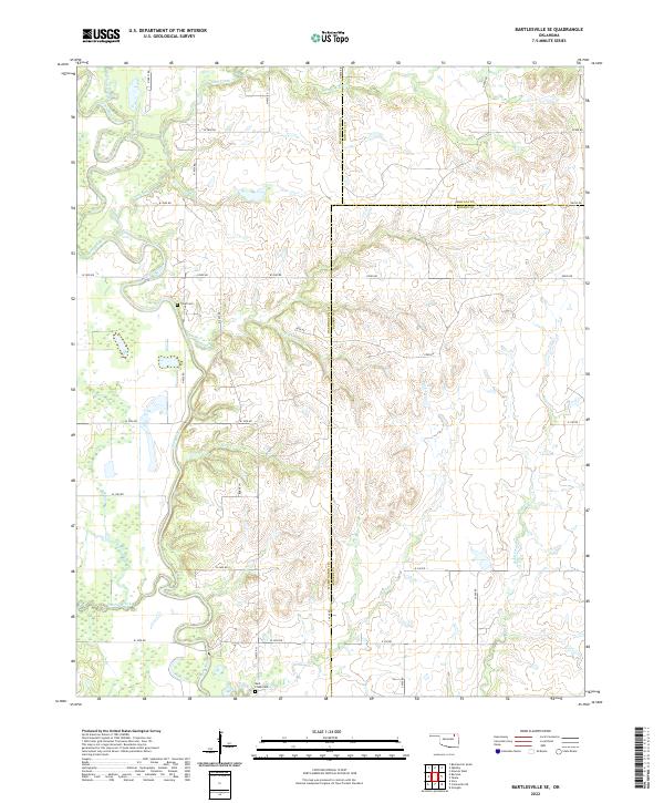
2022 Map of Bartlesville SE
USGS Topo · Published 2022About this map
Caney River winds through the western edge of this landscape, carving a fertile valley where Washington, Nowata, and Rogers counties meet. The terrain is defined by a dense network of watercourses, including the long reach of Rabb Creek in the east and Double Creek to the south. This survey captures a rural Oklahoma setting where the land remains largely partitioned by a regular grid of county roads, such as W 3000 RD and N 4030 RD. Scattered throughout these sections are small, significant sites of local heritage, most notably Tyner Cem and Buck Creek Cem, which serve as quiet anchors for the region's family histories. The presence of Timberlake Creek and Stick Cr feeding into larger systems illustrates the complex drainage of this prairie-border country before it reaches the larger Oklahoma reservoirs.
Find a feature on this map
48 named features on this map. Tap any name to fly to it.
Don’t see what you’re looking for? This feature index may not catch every label — zoom into the map to look around manually.
Map Details
Editions of this 2022 Bartlesville SE Map
This is the sole edition of this map. No revisions or reprints were ever made.
Other maps of this area

1901 · Claremore
USGS Topo · 1:125,000

1901 · Nowata
USGS Topo · 1:125,000

1914 · Nowata
USGS Topo · 1:125,000

1914 · Claremore
USGS Topo · 1:125,000

1916 · Claremore
USGS Topo · 1:125,000

1954 · Tulsa
USGS Topo · 1:250,000

1958 · Tulsa
USGS Topo · 1:250,000

1959 · Collinsville NE
USGS Topo · 1:24,000
1959 · Vera
USGS Topo · 1:24,000

1963 · Tulsa
USGS Topo · 1:250,000