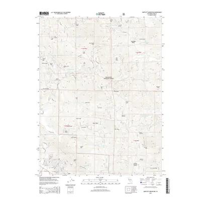
2015 Map of Bartlett Mountain
USGS Topo · Published 2015About this map
Mendocino National Forest dominates the high-elevation terrain of Lake County, where steep drainages like N Fork Cache Cr and Rice Fork carve through the coastal range. The 2015 survey reveals a landscape primarily defined by its topographic extremes and historical landholdings, such as Rose Place and Wild Bill Place. The transition from the high wilderness of Bartlett Moutain down toward the southern edge of the map shows a marked shift in development. Near the northern shores of Clear Lake, the community of Nice appears with its established street grid, including Lake View Dr and Panoramic Cir. This area contrasts with the remote interior, where features like High Glade Spring and Sulphur Spring indicate the natural hydrology of the mountain valleys. Geologists and local historians can trace the network of forest roads, including the Bartlett Springs Rd, which historically connected the interior springs to the settled valleys below.
Find a feature on this map
85 named features on this map. Tap any name to fly to it.
Don’t see what you’re looking for? This feature index may not catch every label — zoom into the map to look around manually.
Map Details
Editions of this 2015 Bartlett Mountain Map
This is the sole edition of this map. No revisions or reprints were ever made.
Other maps of this area

1922 · Hullville
USGS Topo · 1:62,500

1924 · Bartlett Springs
USGS Topo · 1:62,500

1938 · Lakeport
USGS Topo · 1:62,500

1942 · Bartlett Springs
USGS Topo · 1:62,500

1944 · Bartlett Springs
USGS Topo · 1:62,500

1951 · Lake Pillsbury
USGS Topo · 1:62,500

1951 · Lakeport
USGS Topo · 1:62,500

1951 · Stonyford
USGS Topo · 1:62,500

1957 · Ukiah
USGS Topo · 1:250,000

1958 · Clearlake Oaks
USGS Topo · 1:24,000