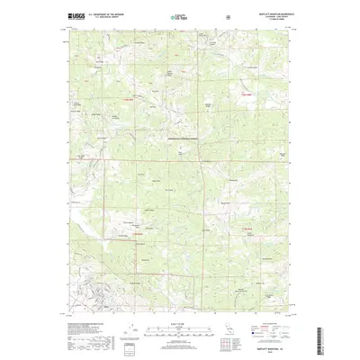
2018 Map of Bartlett Mountain
USGS Topo · Published 2018About this map
Nice sits at the southern edge of this study, serving as a gateway to the steep ridges and hidden basins of the Mendocino National Forest. The landscape is defined by its complex drainage network, where the Rice Fork flows northward while the southern canyons lead toward Clover Valley and the expansive Wilson Valley. This 2018 survey reveals a terrain crisscrossed by essential fire management features, such as the Pitney Fuel Break, which follows the high ground of Pitney Ridge. The abundance of named water sources, including Sulphur Spring, Hazel Spring, and High Glade Spring, indicates a region where water accessibility was critical for both forest management and early high-altitude grazing. From the prominence of Bartlett Mtn to the depths of Swede Canyon, the map provides a detailed view of the remote interior of Lake County before recent environmental shifts.
Find a feature on this map
109 named features on this map. Tap any name to fly to it.
Don’t see what you’re looking for? This feature index may not catch every label — zoom into the map to look around manually.
Map Details
Editions of this 2018 Bartlett Mountain Map
This is the sole edition of this map. No revisions or reprints were ever made.
Other maps of this area

1922 · Hullville
USGS Topo · 1:62,500

1924 · Bartlett Springs
USGS Topo · 1:62,500

1938 · Lakeport
USGS Topo · 1:62,500

1942 · Bartlett Springs
USGS Topo · 1:62,500

1944 · Bartlett Springs
USGS Topo · 1:62,500

1951 · Lake Pillsbury
USGS Topo · 1:62,500

1951 · Lakeport
USGS Topo · 1:62,500

1951 · Stonyford
USGS Topo · 1:62,500

1957 · Ukiah
USGS Topo · 1:250,000

1958 · Clearlake Oaks
USGS Topo · 1:24,000