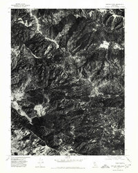
1977 Map of Bartlett Mtn
USGS Topo · Published 1980About this map
The northern reaches of the Clover valley system meet the high ridges of Lake County in this late-1970s orthophotograph. Unlike traditional line-drawn maps, this aerial perspective reveals the exact texture of the chaparral and timbered slopes, documenting the precise extent of vegetation and land clearing during the era. Small pockets of flat land like Twin Valley provide sharp contrast to the dense, shadow-draped canyons that characterize this part of the California Coast Ranges. The map serves as a physical record of the landscape before more modern developments or fire cycles may have altered the visual patterns of the hillsides and ranch lands.
Find a feature on this map
2 named features on this map. Tap any name to fly to it.
Don’t see what you’re looking for? This feature index may not catch every label — zoom into the map to look around manually.
Map Details
Editions of this 1977 Bartlett Mtn Map
This is the sole edition of this map. No revisions or reprints were ever made.
Other maps of this area

1922 · Hullville
USGS Topo · 1:62,500

1924 · Bartlett Springs
USGS Topo · 1:62,500

1938 · Lakeport
USGS Topo · 1:62,500

1942 · Bartlett Springs
USGS Topo · 1:62,500

1944 · Bartlett Springs
USGS Topo · 1:62,500

1951 · Lake Pillsbury
USGS Topo · 1:62,500

1951 · Lakeport
USGS Topo · 1:62,500

1951 · Stonyford
USGS Topo · 1:62,500

1957 · Ukiah
USGS Topo · 1:250,000

1958 · Clearlake Oaks
USGS Topo · 1:24,000