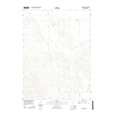
2014 Map of Bartlett NW
USGS Topo · Published 2014About this map
Buffalo Flats dominates the northern landscape of this Wheeler County terrain, where the undulating Sandhills topography of Nebraska is clearly visible through fine-grained contour lines. The seasonal and intermittent flow of Beaver Cr skirts the northeastern corner, providing a vital water source in this predominantly agricultural and ranching region. A grid of local section-line roads, including 839th Rd and 491st Ave, provides access to the interior, while the distinctive Dorn Loop suggests a family-named ranching access route or historical boundary. The map illustrates a classic Great Plains settlement pattern where wide-open spaces are organized by a rigid rectangular survey system, punctuated by occasional depressions and small water bodies that define the local hydrology.
Find a feature on this map
10 named features on this map. Tap any name to fly to it.
Don’t see what you’re looking for? This feature index may not catch every label — zoom into the map to look around manually.
Map Details
Editions of this 2014 Bartlett NW Map
This is the sole edition of this map. No revisions or reprints were ever made.
Other maps of this area

1954 · Gables SE
USGS Topo · 1:24,000

1954 · Bartlett NW
USGS Topo · 1:24,000

1954 · Bartlett SE
USGS Topo · 1:24,000

1954 · Bartlett
USGS Topo · 1:24,000

1954 · Ericson
USGS Topo · 1:24,000

1954 · Gables
USGS Topo · 1:24,000

1955 · Broken Bow
USGS Topo · 1:250,000

1955 · O'Neill
USGS Topo · 1:250,000

1956 · Broken Bow
USGS Topo · 1:250,000

1959 · O'Neill
USGS Topo · 1:250,000