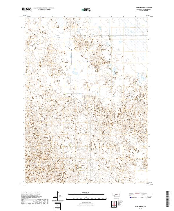
2021 Map of Bartlett NW
USGS Topo · Published 2021About this map
Buffalo Flats dominates the northeastern reaches of this Wheeler County landscape, characterized by the undulating sand hills typical of central Nebraska. This 2021 survey reveals a sparsely populated terrain where the natural topography dictates the movement of water and the placement of roads. In the far northeast corner, the waters of Beaver Cr cut through the plains, representing the primary drainage for the area. The human presence here is defined by a rigid section-line grid of gravel and dirt routes, including 839th Rd, 489 Ave, and 832 Rd. These roads segment the territory into the traditional townships of t23n r12w, t23n r11w, t22n r12w, and t22n r11w, illustrating the enduring influence of the Public Land Survey System on the Nebraska ranching interior.
Find a feature on this map
15 named features on this map. Tap any name to fly to it.
Don’t see what you’re looking for? This feature index may not catch every label — zoom into the map to look around manually.
Map Details
Editions of this 2021 Bartlett NW Map
This is the sole edition of this map. No revisions or reprints were ever made.
Other maps of this area

1954 · Gables SE
USGS Topo · 1:24,000

1954 · Bartlett NW
USGS Topo · 1:24,000

1954 · Bartlett SE
USGS Topo · 1:24,000

1954 · Bartlett
USGS Topo · 1:24,000

1954 · Ericson
USGS Topo · 1:24,000

1954 · Gables
USGS Topo · 1:24,000

1955 · Broken Bow
USGS Topo · 1:250,000

1955 · O'Neill
USGS Topo · 1:250,000

1956 · Broken Bow
USGS Topo · 1:250,000

1959 · O'Neill
USGS Topo · 1:250,000