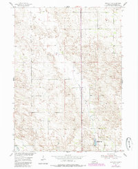
1954 Map of Bartlett SE
USGS Topo · Published 1985About this map
Clear Creek meanders through the central landscape of Wheeler County in this mid-century survey, defining a topography shaped by seasonal water and the Nebraska Sandhills. The area is anchored by the Pibel Lake State Recreation Area, a focal point for local geography where Pibel Lake and the nearby Pibel Cem suggest a long-established community presence centered around the water. The mapping reflects a rural landscape where infrastructure is sparse and tied directly to the land's utility, marked by numerous Windmill sites used for livestock watering.
Find a feature on this map
10 named features on this map. Tap any name to fly to it.
Don’t see what you’re looking for? This feature index may not catch every label — zoom into the map to look around manually.
Map Details
Editions of this 1954 Bartlett SE Map
2 editions found
Other maps of this area

1954 · Greeley NE
USGS Topo · 1:24,000

1954 · Greeley NW
USGS Topo · 1:24,000

1954 · Bartlett NW
USGS Topo · 1:24,000

1954 · Spalding NW
USGS Topo · 1:24,000

1954 · Bartlett SE
USGS Topo · 1:24,000

1954 · Bartlett
USGS Topo · 1:24,000

1954 · Ericson
USGS Topo · 1:24,000

1955 · Broken Bow
USGS Topo · 1:250,000

1956 · Broken Bow
USGS Topo · 1:250,000

1960 · Spalding 2 SW
USGS Topo · 1:24,000