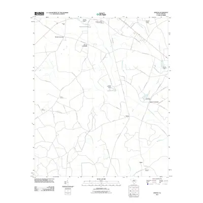
2011 Map of Barton
USGS Topo · Published 2011About this map
The Coosawhatchie River meanders through this portion of Allendale County, anchoring a landscape defined by historic rural junctions and a network of named ponds. Small settlements like Barton, Lopers Crossroads, and Woods Crossroads mark the intersections of local life, while Revolutionary Trl suggests deep local connections to the region's early history. The distribution of family-named water features, such as Harters Pond Dam and Sanders Pond Dam, reflects a traditional agricultural economy reliant on managed waterways. Several burial grounds, including Swallow Savanna Cemetery and Mount Zion Cemetery, offer vital points of interest for genealogists tracing regional family lines near Rouse and Moores Crossroads. The presence of the Allendale County Airport and Allendale Wastewater Treatment Facility at the northern edge indicates the modern infrastructure supporting this otherwise quiet corner of the South Carolina Lowcountry.
Find a feature on this map
58 named features on this map. Tap any name to fly to it.
Don’t see what you’re looking for? This feature index may not catch every label — zoom into the map to look around manually.
Map Details
Editions of this 2011 Barton Map
This is the sole edition of this map. No revisions or reprints were ever made.
Other maps of this area

1918 · Varnville
USGS Topo · 1:62,500

1919 · Olar
USGS Topo · 1:62,500

1919 · Allendale
USGS Topo · 1:62,500

1920 · Peeples
USGS Topo · 1:62,500

1943 · Olar
USGS Topo · 1:62,500

1943 · Allendale
USGS Topo · 1:62,500

1943 · Peeples
USGS Topo · 1:62,500

1944 · Varnville
USGS Topo · 1:62,500

1947 · Savannah
USGS Topo · 1:250,000

1948 · Savannah
USGS Topo · 1:250,000