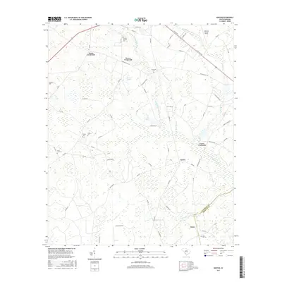
2017 Map of Barton
USGS Topo · Published 2017About this map
The Coosawhatchie River meanders through this South Carolina landscape, defining the rural character of the region where the Allendale Co Hampton Co boundary is established. Settlement patterns are largely concentrated at various hubs like Barton, Woods Crossroads, and Lopers Crossroads, which serve as junctions for local travel. The presence of numerous small burying grounds, including Swallow Savanna Cem, Smyrna Cem, and New Home Cem, offers significant detail for researchers documenting local family history and the distribution of early communities. The map also captures the local aviation footprint at the Allendale County Airport and the intersection of vital regional arteries such as Charleston Ave and the Fairfax-Barton Hwy. To the south, Levy Bay and Beech Br represent the hydrological system that supports the agricultural and forested lands surrounding Rouse.
Find a feature on this map
67 named features on this map. Tap any name to fly to it.
Don’t see what you’re looking for? This feature index may not catch every label — zoom into the map to look around manually.
Map Details
Editions of this 2017 Barton Map
This is the sole edition of this map. No revisions or reprints were ever made.
Other maps of this area

1918 · Varnville
USGS Topo · 1:62,500

1919 · Olar
USGS Topo · 1:62,500

1919 · Allendale
USGS Topo · 1:62,500

1920 · Peeples
USGS Topo · 1:62,500

1943 · Olar
USGS Topo · 1:62,500

1943 · Allendale
USGS Topo · 1:62,500

1943 · Peeples
USGS Topo · 1:62,500

1944 · Varnville
USGS Topo · 1:62,500

1947 · Savannah
USGS Topo · 1:250,000

1948 · Savannah
USGS Topo · 1:250,000