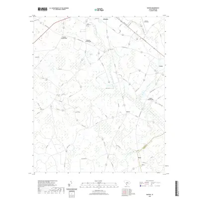
2020 Map of Barton
USGS Topo · Published 2020About this map
Woods Crossroads and Moores Crossroads anchor the upper reaches of this Lowcountry landscape, where the Coosawhatchie River and its numerous tributaries like Little Duck Branch drain the marshy terrain. The map reveals a dense network of family and community history through its many burial grounds, including the Smart Cemeteries and Smyrna Cem. The transition from the established seat of Allendale in the north down toward Barton and the Allendale-Hampton county line is marked by a mix of agricultural fields and significant wetlands such as Swallow Savanna and Levy Bay. For the local researcher, the placement of landmarks like the Allendale County Airport and the distinct junction at Lopers Crossroads provides clear spatial context for modern and historic land use patterns in this rural corridor.
Find a feature on this map
78 named features on this map. Tap any name to fly to it.
Don’t see what you’re looking for? This feature index may not catch every label — zoom into the map to look around manually.
Map Details
Editions of this 2020 Barton Map
This is the sole edition of this map. No revisions or reprints were ever made.
Other maps of this area

1918 · Varnville
USGS Topo · 1:62,500

1919 · Olar
USGS Topo · 1:62,500

1919 · Allendale
USGS Topo · 1:62,500

1920 · Peeples
USGS Topo · 1:62,500

1943 · Olar
USGS Topo · 1:62,500

1943 · Allendale
USGS Topo · 1:62,500

1943 · Peeples
USGS Topo · 1:62,500

1944 · Varnville
USGS Topo · 1:62,500

1947 · Savannah
USGS Topo · 1:250,000

1948 · Savannah
USGS Topo · 1:250,000