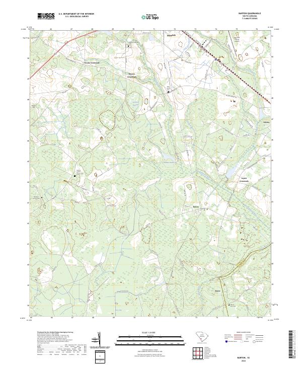
2024 Map of Barton
USGS Topo · Published 2024About this map
The Coosawhatchie River defines the drainage of this Lowcountry landscape, flowing through a network of wetlands and agricultural lands near the Allendale and Hampton County line. The area is characterized by scattered rural communities and crossroads, including Barton, Woods Crossroads, and Moores Crossroads, which serve as focal points for the surrounding timber and farm acreage. Local history is anchored by numerous family and community burial grounds, such as the Smyma Baptist Church Cem and the Brunson - Smart Cem.
Find a feature on this map
80 named features on this map. Tap any name to fly to it.
Don’t see what you’re looking for? This feature index may not catch every label — zoom into the map to look around manually.
Map Details
Editions of this 2024 Barton Map
This is the sole edition of this map. No revisions or reprints were ever made.
Other maps of this area

1918 · Varnville
USGS Topo · 1:62,500

1919 · Olar
USGS Topo · 1:62,500

1919 · Allendale
USGS Topo · 1:62,500

1920 · Peeples
USGS Topo · 1:62,500

1943 · Olar
USGS Topo · 1:62,500

1943 · Allendale
USGS Topo · 1:62,500

1943 · Peeples
USGS Topo · 1:62,500

1944 · Varnville
USGS Topo · 1:62,500

1947 · Savannah
USGS Topo · 1:250,000

1948 · Savannah
USGS Topo · 1:250,000