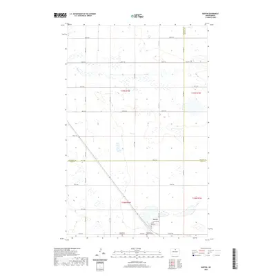
2020 Map of Barton
USGS Topo · Published 2020About this map
The settlement of Barton anchors the southern portion of this northern prairie landscape, situated near the intersection of several county boundaries. The terrain is defined by the winding paths of Ox Cr and Willow Cr, which snake through the section lines of the PLSS grid. This modern survey illustrates the enduring agricultural layout of the region, where a network of gravel roads like Willow City Rd and numbered section lines connect isolated farmsteads and rural landmarks. For those researching local heritage, the map identifies two distinct burial grounds on the outskirts of the primary settlement: West Barton Lutheran Cem and East Barton Lutheran Cem. These sites, along with the neighborhood streets of Lake St and Barton St, provide a clear view of the community's structural footprint where Pierce, Bottineau, and Rolette counties meet.
Find a feature on this map
25 named features on this map. Tap any name to fly to it.
Don’t see what you’re looking for? This feature index may not catch every label — zoom into the map to look around manually.
Map Details
Editions of this 2020 Barton Map
This is the sole edition of this map. No revisions or reprints were ever made.
Other maps of this area

1954 · Towner NE
USGS Topo · 1:24,000

1954 · Overly SE
USGS Topo · 1:24,000

1954 · Omemee
USGS Topo · 1:24,000

1954 · Barton
USGS Topo · 1:24,000

1954 · Round Lake
USGS Topo · 1:24,000

1954 · Leverich
USGS Topo · 1:24,000

1954 · Willow City
USGS Topo · 1:24,000

1954 · Minot
USGS Topo · 1:250,000

1955 · Fonda
USGS Topo · 1:24,000

1955 · Overly
USGS Topo · 1:24,000