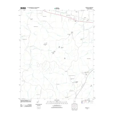
2011 Map of Barton
USGS Topo · Published 2011About this map
Barton and the high ridges of Sand Mountain anchor this landscape in northwestern Alabama, where the Norfolk Southern railroad tracks run parallel to the Old Lee Hwy. The map documents a territory defined by complex topography, featuring many family-named hollows and ridges such as Burcham Hollow, Bugg Mill Hollow, and Red Rock Ridge. Genealogists will find a high density of burial sites scattered across the terrain, including the New Newsom Springs Cemetery and the uniquely named Coondog Cemetery near Sugar Camp Branch.
Find a feature on this map
72 named features on this map. Tap any name to fly to it.
Don’t see what you’re looking for? This feature index may not catch every label — zoom into the map to look around manually.
Map Details
Editions of this 2011 Barton Map
This is the sole edition of this map. No revisions or reprints were ever made.
Other maps of this area

1911 · Iuka
USGS Topo · 1:48,000

1914 · Iuka
USGS Topo · 1:62,500

1924 · Gravelly Springs
USGS Topo · 1:48,000

1925 · Barton
USGS Topo · 1:62,500

1926 · Barton
USGS Topo · 1:48,000

1926 · Gravelly Springs
USGS Topo · 1:62,500

1929 · Barton
USGS Topo · 1:62,500

1935 · Cherokee
USGS Topo · 1:24,000

1935 · Pleasant Site
USGS Topo · 1:24,000

1936 · Margerum
USGS Topo · 1:24,000