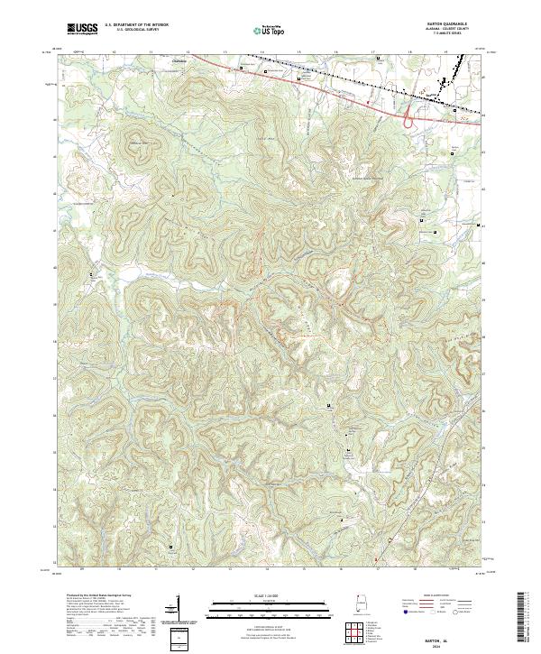
2024 Map of Barton
USGS Topo · Published 2024About this map
The town of Cherokee and the settlement of Barton anchor the northern landscape of this quadrangle, situated along the corridor of Route 72. The area is characterized by a complex network of ridges and hollows, including Mountain Mills Ridge and Summer House Mountain, which give way to numerous winding waterways like Buzzard Roost Creek and McLemore Branch. This modern survey reveals a region with deep community roots, evidenced by the high density of small family and local burial grounds such as Atkisson Cem, McCollough Cem, and the unique Coon Dog Cem located in the south.
Find a feature on this map
96 named features on this map. Tap any name to fly to it.
Don’t see what you’re looking for? This feature index may not catch every label — zoom into the map to look around manually.
Map Details
Editions of this 2024 Barton Map
This is the sole edition of this map. No revisions or reprints were ever made.
Other maps of this area

1911 · Iuka
USGS Topo · 1:48,000

1914 · Iuka
USGS Topo · 1:62,500

1924 · Gravelly Springs
USGS Topo · 1:48,000

1925 · Barton
USGS Topo · 1:62,500

1926 · Barton
USGS Topo · 1:48,000

1926 · Gravelly Springs
USGS Topo · 1:62,500

1929 · Barton
USGS Topo · 1:62,500

1935 · Cherokee
USGS Topo · 1:24,000

1935 · Pleasant Site
USGS Topo · 1:24,000

1936 · Margerum
USGS Topo · 1:24,000