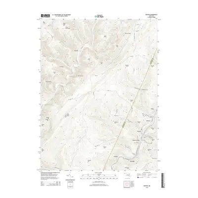
2014 Map of Barton
USGS Topo · Published 2014About this map
The Savage River corridor and its winding tributaries dominate this 2014 survey of the Maryland highlands. The drainage patterns of Warnick Run, Elk Lick Run, and Poplar Lick Run create a deeply dissected landscape of ridges like Pea Ridge and Fourmile Ridge. In the eastern section, the terrain transitions to the industrial and residential cluster of Barton, Moscow, and Nikep, situated along the banks of Georges Creek. This area shows the intersection of human settlement and geological resource management, notably seen in the Barton Debris Basin and the numerous small cemeteries that dot the hillsides, including Saint Gabriels Cem and Moscow Mills Cem. The boundary between Garrett and Allegany counties runs through the center of these steep hollows, marking a divide between the wilder river valleys and the developed creek bottoms of the George's Creek Valley.
Find a feature on this map
83 named features on this map. Tap any name to fly to it.
Don’t see what you’re looking for? This feature index may not catch every label — zoom into the map to look around manually.
Map Details
Editions of this 2014 Barton Map
This is the sole edition of this map. No revisions or reprints were ever made.
Other maps of this area

1891 · Romney
USGS Topo · 1:125,000

1895 · Piedmont
USGS Topo · 1:125,000

1898 · Frostburg
USGS Topo · 1:62,500

1899 · Grantsville
USGS Topo · 1:62,500

1901 · Frostburg
USGS Topo · 1:62,500

1904 · Grantsville
USGS Topo · 1:62,500

1908 · Frostburg
USGS Topo · 1:62,500

1919 · Elk Garden
USGS Topo · 1:48,000

1920 · Elk Garden
USGS Topo · 1:48,000

1920 · Keyser
USGS Topo · 1:62,500