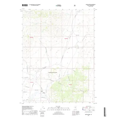
2018 Map of Barton Spring
USGS Topo · Published 2018About this map
Toiyabe National Forest dominates the southern reaches of this landscape, where the high desert terrain is defined by a series of steep canyons and essential water sources. The map reveals a network of canyons including Emigrant Canyon, Simpson Park Canyon, and Thorpe Canyon, which carve through the mountains leading toward Mt Prometheus. In an arid environment where water dictates movement, named springs like Barton Spring, Windlass Spring, and Streshley Spring serve as critical landmarks for ranchers and travelers.
Find a feature on this map
30 named features on this map. Tap any name to fly to it.
Don’t see what you’re looking for? This feature index may not catch every label — zoom into the map to look around manually.
Map Details
Editions of this 2018 Barton Spring Map
This is the sole edition of this map. No revisions or reprints were ever made.
Other maps of this area

1926 · Roberts Mountains
USGS Topo · 1:250,000

1929 · Roberts Mountains
USGS Topo · 1:250,000

1955 · Millett
USGS Topo · 1:250,000

1956 · Mount Callaghan
USGS Topo · 1:62,500

1956 · Austin
USGS Topo · 1:62,500

1959 · Millett
USGS Topo · 1:250,000

1960 · Spencer Hot Springs
USGS Topo · 1:62,500

1969 · Yankee Blade
USGS Topo · 1:24,000

1969 · Vigus Butte NE
USGS Topo · 1:24,000

1978 · Summit Mountain
USGS Topo · 1:100,000